
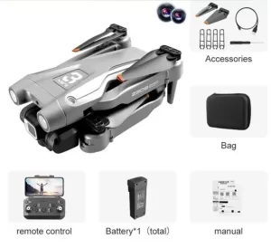
1


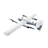


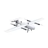

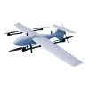
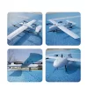

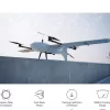

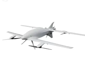
VTOL Fixed Wing Multipurpose 260Km Long Range
$27,724.62
In stock
Calculate shipping price
Please fill in the fields below with the shipping destination details in order to calculate the shipping cost.
Description
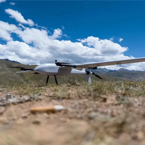
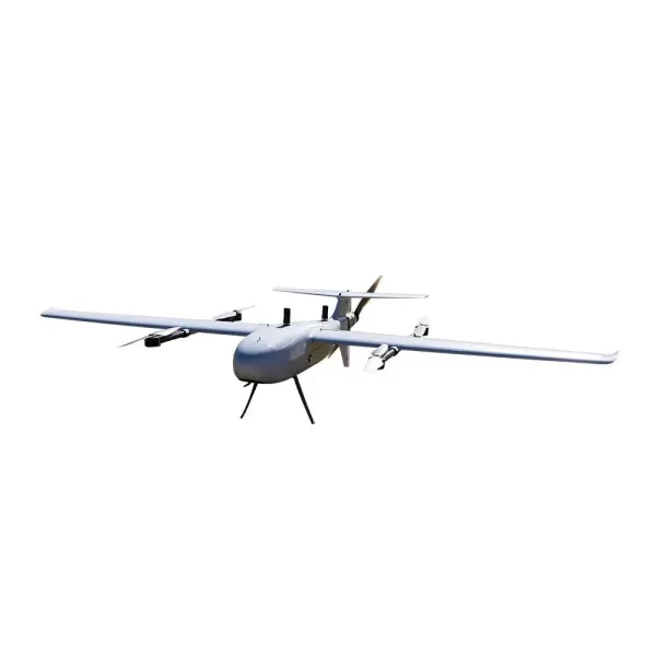
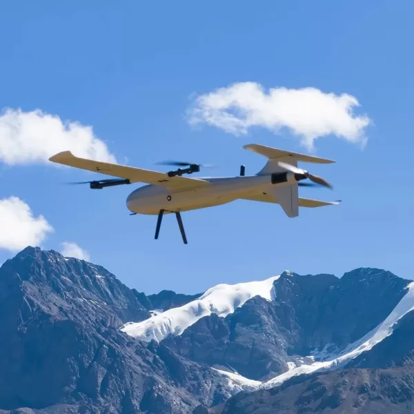
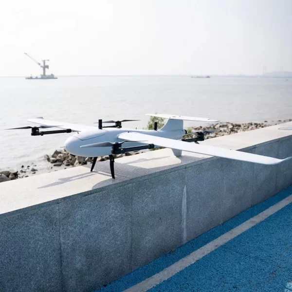
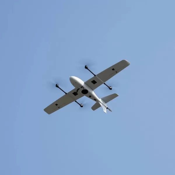
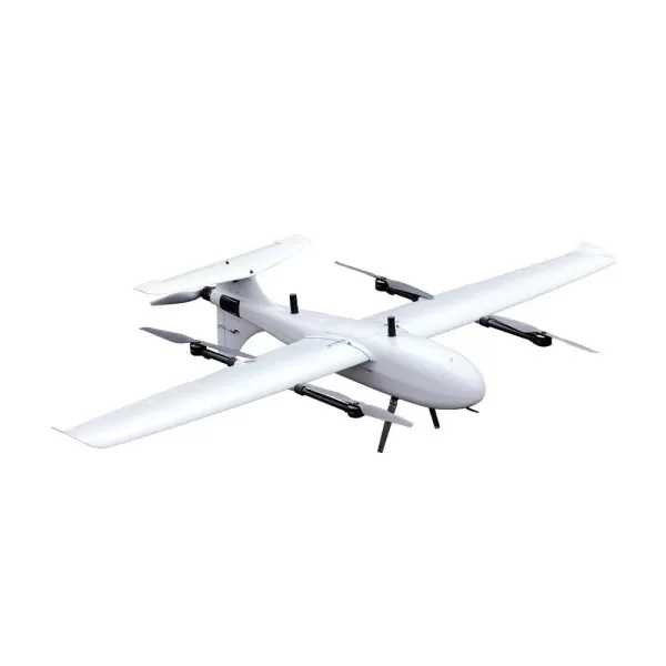
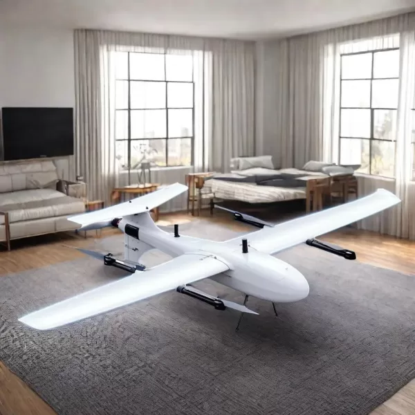
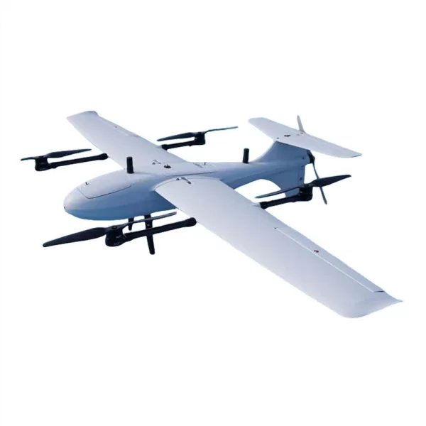
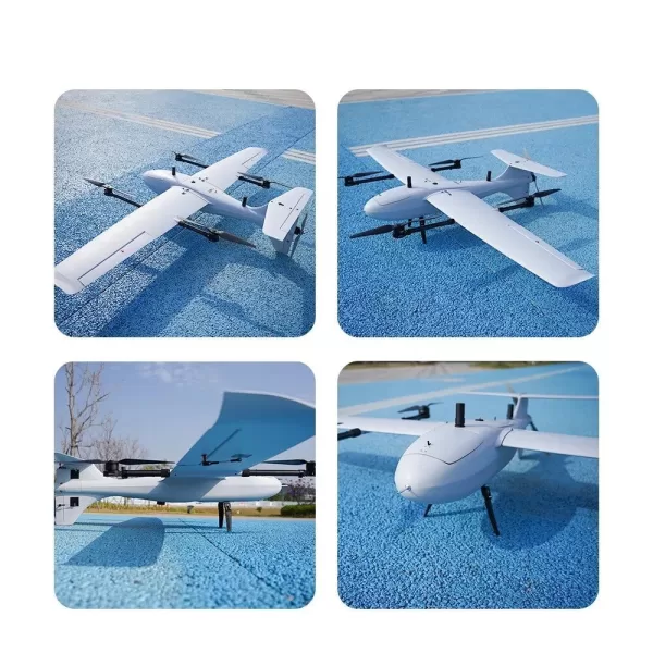
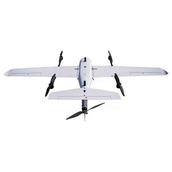
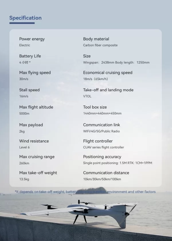
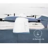
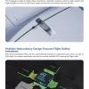
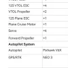
The Vertical Take-Off and Landing (VTOL) fixed-wing multipurpose drone is an unmanned aerial vehicle (UAV) that combines the flight characteristics of a helicopter and a conventional airplane. It uses rotors for vertical lift and landing, allowing it to operate in confined areas without a runway. Once airborne, it transitions to highly efficient fixed-wing flight for longer range and endurance.
This hybrid functionality makes it a versatile tool for a wide array of applications across various industries, balancing the maneuverability of multirotors with the speed and efficiency of fixed-wing aircraft.
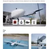
Key features
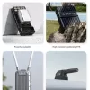
- Hybrid flight capability: This is the core feature, enabling the drone to take off and land vertically in tight spaces, then seamlessly switch to efficient forward flight using its wings.
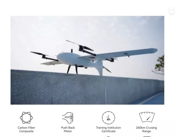
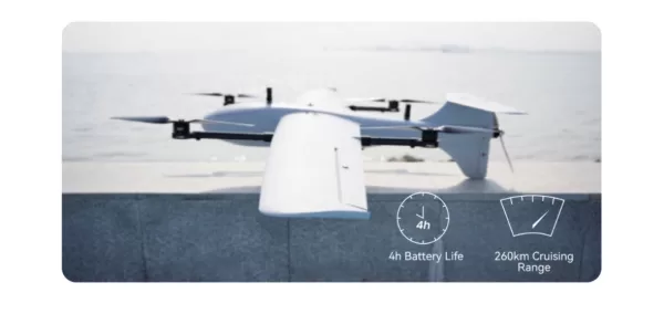
- Long endurance and range: The energy-efficient fixed-wing mode allows it to cover vast areas for extended periods, far surpassing the flight time of most multirotor drones.
- Higher payload capacity: The fixed-wing design is capable of carrying heavier and more sophisticated payloads, such as high-resolution cameras, thermal sensors, and LiDAR scanners.
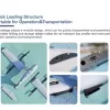
- Adaptability to environments: Its VTOL ability removes the need for runways, making it ideal for deployment in rugged terrain, dense forests, urban areas, or on the decks of ships.
- Multi-mission versatility: The ability to swap or carry multiple payloads, combined with different flight modes, allows a single platform to be configured for a variety of tasks.
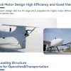
- Autonomous operation: Many models are equipped with advanced autopilot systems for autonomous flight planning, navigation, and transitions between flight modes.
Multipurpose applications
- Mapping and surveying: Can cover large areas quickly to create high-resolution maps, 3D models, and collect topographical data for agriculture, mining, and urban planning.
- Surveillance and security: Provides persistent, long-range intelligence, surveillance, and reconnaissance (ISR) for military operations, border patrols, and monitoring critical infrastructure like pipelines.
- Search and rescue: Can be deployed rapidly to locate missing persons, assess disaster zones, or deliver critical supplies in hard-to-reach areas.
- Logistics and delivery: Capable of transporting goods, medical supplies, and other cargo to remote or inaccessible locations.
- Environmental monitoring: Used to monitor wildlife, track environmental changes, and assess damage from events like deforestation or natural disasters.
- Infrastructure inspection: Inspects long, linear assets such as power lines, pipelines, and railways more efficiently than multirotor drones.
- Precision agriculture: Can carry multispectral sensors to analyze crop health, monitor irrigation, and assist with smart farm management.
-
Globe SP40 40-Quart Floor Planetary Mixer, NSF
$13,269.30 Add to cart -
Presidium GEM Indicator PGI – Colored Gemstone Diamond Tester
$395.41 Add to cart -
iCarsoft NS v1.0 Car Diagnostic Scanner Reset Tool FOR SUBARU 2021 Version AU
$197.03 Add to cart -

XYGUOXINGYY Post-Modern Minimalist Creative Art Glass Round Villa Hotel Decorative Lighting 8 – Round D60cm Light Transmission Long Life
$6,133.23 Add to cart -
NNEDSZ Smart Digital Display Bluetooth Earphones With Transparent Capsule Design
$60.27 Add to cart -
Plustek Wide-Format Color Duplex Document Scanner S30, for Large-Format Document Scan, Scans Wide Up to 12″ and Long Up to 200″, 100-Sheet Duplex Auto Document Feeder
$548.90 Add to cart
Related Products
-
VTOL Fixed Wing UAV Long Range
$97,391.85 Add to cart -
Z908 pro drone with 4k camera
$211.72 Add to cart -
![[UNUSED in Box] Canon XF400 4K UHD 60P Professional Camcorder Japan](https://bymatics.com/wp-content/uploads/2025/10/s-l1600_a8f623a0-044d-442d-8e53-d48720edb8dc-300x200.webp)
Canon XF400 4K UHD 60P Professional Camcorder
$2,608.94 Add to cart -
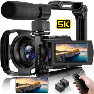
iSmart 5K HD Video Camera Camcorder 48MP Vlog Camera for Youtube with IR Night Vision Wifi 3.0” Touch Screen
$203.02 Add to cart -
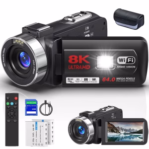
Camco 8K Video Camera for Youtube 64MP 18X Digital Zoom 3.0 Inch Flip Screen Camcorder Vlogging Camera with 32GB SD Card
$177.29 Add to cart -
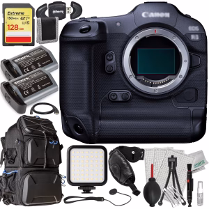
Advanced Canon R3 Mirrorless Camera Bundle (Body Only) – Includes: 128GB Extreme SDXC, 2X Replacement Batteries, Deluxe Water-Resistant Camera Backpack & Much More
$7,317.84 Add to cart -
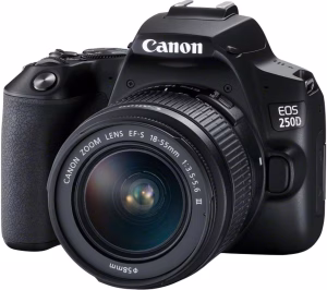
Canon EOS 250D/SL3 18-55 III Black (International Version)
$909.06 Add to cart -
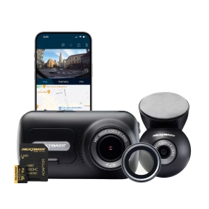
Nextbase 322GW 1080P Dash Cam Bundle
$362.25 Add to cart -
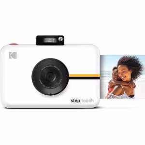
Step Touch 13MP Digital Camera & Instant Printer with 3.5” LCD Touchscreen Display (White)
$241.62 Add to cart

Reviews
There are no reviews yet.